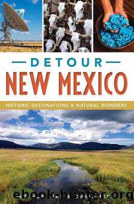
Detour New Mexico by Arthur Pike David Pike

Author:Arthur Pike, David Pike [Arthur Pike, David Pike]
Language: eng
Format: epub
Tags: History, United States, State & Local, Southwest (AZ; NM; OK; TX)
ISBN: 9781540214119
Google: _mmiAQAACAAJ
Publisher: Arcadia Publishing (SC)
Published: 2017-01-23T15:55:20+00:00
Historic Rio Puerco bridge along old Route 66. Photo by David Pike.
From here, you need to get back onto the interstate and continue west (the frontage road visible to your right is the old road, but it dead ends). The interstate runs over the route of the original 66, just as that road followed the worn path of the older National Old Trails Road.
Take Exit 126 toward Los Lunas, turn left, cross the interstate and hop on NM 6 until you reach an intersection with a railroad bridge to your right. This is Correo. The name is the Spanish word for âmailâ and was selected because the post office here was the only one for miles around. You wouldnât know it today, but this humble spot looms large in Route 66 history. It was in Correo that the pre-1937 alignment road, which ran south from Albuquerque to Los Lunas and then turned west to Laguna Pueblo, met the post-1937 alignment, which ran from Albuquerque to Laguna Pueblo and was known as the Laguna Cutoff. The pre-1937 alignment route coming northwest roughly thirty miles from Los Lunas is now NM 6. Meanwhile, the remains of the Laguna Cutoff running from the east can still be seen here but are not passable. They testify to the force of politics on detouring history.
Jack D. Rittenhouse, whose Guide Book to Highway 66, published in 1946, was the first comprehensive guide to the Mother Road, offered this description of Correo as it looked in that year:
Here there are two establishments, one on each side of a railroad, which crosses U.S. 66. Correo (Pop. 10) offers gas, groceries, small café, and a few cabins. As is the case with most roadside establishments along here, these places carry a display of curios, jewelry, and Navajo rugs.
Return to the interstate and go about fifteen minutes to the Mesita exit. As you continue west on the frontage road from this point, youâll be traveling through what is easily one of the most beautiful sections of old 66. (Though remember you are on the Laguna Reservation; observe all posted signs.) When you round the corner past mile marker 3, Owl Rock swoops into view. The rock formation looks like a somewhat-broad-in-the-beam, giant rock owl perched along the northern edge of the highway. Old postcards of the rock show that wind and rain havenât yet taken a toll on its distinctive shape.
While youâre traveling this beautiful stretch, itâs a good time to think about the impact that Route 66 had on our cultural history. In recent years, the National Park Serviceâcharged with preserving the architectural and human history of Route 66 through the Route 66 Corridor Preservation Programâhas studied the experience of minorities along Route 66, finding that those 2,500 miles from Chicago to Santa Monica meant different things to different people. Before the passage of the Civil Rights Act in 1964, black motorists were likely to experience discrimination as they traveled. So they turned to guides like The Negro Motorist Green Book, commonly known as the âGreen Book,â published by Victor H.
Download
This site does not store any files on its server. We only index and link to content provided by other sites. Please contact the content providers to delete copyright contents if any and email us, we'll remove relevant links or contents immediately.
| Acoustics | Bridges |
| Earthwork Design | Environmental |
| Fire Science | Highway & Traffic |
| Hydrology | Remote Sensing |
| Seismic Design | Structural |
| Structural Dynamics | Surveying & Photogrammetry |
| Transportation |
Whiskies Galore by Ian Buxton(41995)
Introduction to Aircraft Design (Cambridge Aerospace Series) by John P. Fielding(33122)
Small Unmanned Fixed-wing Aircraft Design by Andrew J. Keane Andras Sobester James P. Scanlan & András Sóbester & James P. Scanlan(32796)
Craft Beer for the Homebrewer by Michael Agnew(18237)
Turbulence by E. J. Noyes(8040)
The Complete Stick Figure Physics Tutorials by Allen Sarah(7366)
The Thirst by Nesbo Jo(6932)
Kaplan MCAT General Chemistry Review by Kaplan(6929)
Bad Blood by John Carreyrou(6612)
Modelling of Convective Heat and Mass Transfer in Rotating Flows by Igor V. Shevchuk(6433)
Learning SQL by Alan Beaulieu(6282)
Weapons of Math Destruction by Cathy O'Neil(6267)
Man-made Catastrophes and Risk Information Concealment by Dmitry Chernov & Didier Sornette(6007)
Digital Minimalism by Cal Newport;(5750)
Life 3.0: Being Human in the Age of Artificial Intelligence by Tegmark Max(5550)
iGen by Jean M. Twenge(5409)
Secrets of Antigravity Propulsion: Tesla, UFOs, and Classified Aerospace Technology by Ph.D. Paul A. Laviolette(5369)
Design of Trajectory Optimization Approach for Space Maneuver Vehicle Skip Entry Problems by Runqi Chai & Al Savvaris & Antonios Tsourdos & Senchun Chai(5066)
Pale Blue Dot by Carl Sagan(4996)
